Allow our experienced staff to help you find the products that meet your unique GNSS needs!
What is GPS Heading / GNSS Heading?
In the context of GNSS and GPS, heading is the compass direction in which a device is travelling or should be travelling, measured in degrees from Magnetic North and/or True North.
Today’s cutting-edge GNSS technology and products enable users to accurately determine where a particular object is pointing on the horizontal plane. Heading can be confused with Course Over Ground (COG), the intended direction of travel. COG is the actual direction of motion. Heading is the direction in which a vehicle or a vessel is pointing at any given moment.
A GNSS dual antenna receiver is one way to provide heading. GPS heading and GNSS heading can be determined by comparing the position of the two antennas. There is a minimum distance required between 2 antennas for an accurate heading to be generated. Heading accuracy can be improved by increasing the separation between the 2 antennas.
A GNSS dual antenna system may require that the vehicle/vessel be moving in order to determine the heading. The positioning update rate depends on the application. For example, for a slow moving object, 1 Hz date rate may be sufficient as opposed to 50 Hz for a fast moving one.
Considerations
When you are searching for a GNSS OEM board and/or compass, there a few things you should consider with respect to accurate GPS heading/GNSS heading calculations:
- Degree of Accuracy: Will 0.75° RMS (root of the mean squared) be sufficient enough or do you require 0.3° RMS, or even 0.17° RMS?
- Time Required for Heading Calculation: How quickly will you need to have your heading calculated? Some products will offer almost immediate heading calculations.
- Applications: The product and features you require will depend on the intended application.
- GNSS Outages: How vital is it for you to be able to calculate heading at any time, even during GNSS outages?
- Other calculations: OEM Boards and compasses that offer accurate heading calculations will likely offer heave, pitch, and roll output as well.
Common Applications for GPS Heading/GNSS Heading
- Marine Navigation
- Machine Guidance
- Satellite & communication antennas
- Robotics
- Pointing
- Planes
- Drills & excavators
- And many more…
Products
At TransiTiva, we are proud to offer the best technologies for various GNSS applications. We have several products that will provide accurate GPS heading/GNSS heading information. They include, but are not limited to:
- Hemisphere V102 Compact GPS Compass
- Hemisphere V102 GPS Compass
- Hemisphere V113 GPS/GLONASS Compass
Explore TransiTiva Products
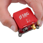
SBG Ellipse – GNSS & Inertial Miniature Systems
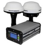
Hemisphere GNSS – Vector VS330 Receiver
Hemisphere GNSS – Crescent Vector H200 GNSS Module
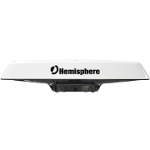
Hemisphere GNSS – V320 GPS Compass
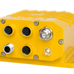
Swift Navigation – Duro
Swift Navigation – Duro Inertial
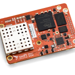
Swift Navigation – Piksi Multi GNSS Module
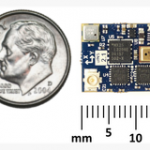
Inertial Sense – μINS